
I call this route the “Lonely Ranger” and it won’t be found on any other blog articles on the internet.
Nha Trang to Hoi An/Danang is one of the most misunderstood sections of Vietnam. Most people think the coast is the right option, but this couldn’t be further from the truth. Due to people getting this wrong, it is known as a boring section of the country to drive, but again, this couldn’t be further from the truth.
In fact, this is arguably the best section of the country to drive, but only I have properly documented it. Leaving others to keep copying and pasting the same out-of-date blog articles about coastal riding that were written well over ten years ago.
In an ideal world, you should get off the coast as quickly as possible and onto my “lonely ranger route. ” However, the coast is a highway, so it is a fast and quick way to get from A to B.
The other nice thing about the coast is that it has accommodation for all budgets, from the very cheap to the very expensive. Inland these days have respectable hotels and restaurants as well. However, there isn’t really anything in the premium price range.
Contents [show]
Coastal highlights
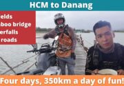
The Bamboo Bridge in Phu Yen
The QL 19C going parallel to the main highway
Inland highlights
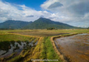
Following my route “the Lonely Ranger” contains the DT669. It is one of the greatest riding roads in the country, passing through An Khe, Mang Den, and nearly all the way up to Danang/Hoi An. Mang Den is also one of the most underrated towns in Vietnam. It’s a strange place where the hotels are large and developed, but there isn’t really anything to do. This is unique in Vietnam, as tourist sites are usually overdeveloped, and we complain of concrete buildings and silly picture/selfie-taking gimmicky structures for Instagram tourists.
Mang Den, on the other hand, has nice waterfalls but nothing to do. You can sit under a tree and read a book. Something that is so rare in this modern day that when we find such a place, we don’t know how to react. This was my feeling anyway.
The roads have a mixture of open straights and meandering corners. It also blends Vietnamese rural life, with empty long sections of road. You can people watch through village life for a while, then suddenly find yourself all alone on a deep jungle road.
A typical itinerary
Day one would be Nha Trang to Quy Nhon through the The Hai Dang pass, on the way into Quy Nhon you can also do the Bamboo bridge.
Day two is Quy Nhon to Mang Den. If you leave Quy Nhon early enough you might just have enough time to get to a waterfall at 4pm.
Day three is Quy Nhon all the way up to Hoi An, which contains some of the best driving in the country.
Waterfall
I have marked on the map various waterfalls, weird bridges, and nice swim spots. However, if you only have time to do one waterfall in the area, it should be Pa Sy waterfall. It was tastefully done and a place that I really wish I could have spent more time in. It’s a commercial setup, though.
Try for that “under a tree reading a book” feel Thác Lô 3 – Măng Đen.
Conclusion
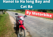
Ho Chi Minh to Danang combines rural Vietnam, which is off the tourist circuit, with good, consistent weather and phenomenal mountain roads with waterfalls dotted along it. It is not surprising that I love this section of the country.


Jon, How do I download your GPS data/route, as mentioned above? Looking to do the Lone ranger on a Honda 500X. Thanks
Click on the map and make it full screen (has to be a PC). In there will be a download to KML button. Email it to yourself, then open the email on your mobile and load up with Maps.me
You will need to download maps.me
Hi there,
is this route ok for Honda Blade? Thanks!
Yes
Hi there
Been on a tigit bike for a while and having a blast! Interested in doing the Lone Ranger from Danang, but not quite sure if it is possible to do in 1 day? Doesn’t look like it. Where do you suggest I bunk down for the night?
Its three days. There are random hotels dotted around that I saw. But they are not on googlemaps
Is this the route breakdown for the 3 day trip from Nha Trang using the Lone Ranger?
Nha Trang –> Ayun Pa –> Kon Pring –> Danang
Yes this looks about right.
Hi dear Tigit Team
I plan to do the lonely ranger route. Do I need to bring extra gasoline?
Best wishes
Stephan
Depends on the motorbike. we had a client on the CRF 250 run out of gas on this trail
Would not recommend the lonely ranger route unless you’re looking to do some off roading and then get turned around 2 hours in from the south cause the road gave way. Was hoping for that “a formula one race car” could drive on it but it was definitely not the case today.
I think you got unlucky with storms. The route is perfectly accessible / in development. So condition will only improve with time